Monday, October 20, 2008

The Bloody Lane: A Tour with Vince Armstrong, Part 2

After a break for lunch, we set off once again from the junction of the Mumma Farm Lane and Smoketown Road to begin the afternoon portion of the tour, covering the attacks of French and Richardson against the Sunken Road. Vince had several surprises in store here as well.

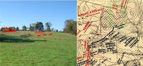
As he reveals in Unfurl Those Colors, Vince does not accept the standard story of French’s Division blundering blindly into combat at the Bloody Lane. Once again, the terrain provides an important clue. During his initial reconnaissance, Sumner would have seen not only Green’s Division in the swale northeast of the Dunker Church, but also the rebel position in the Sunken Road in the area of French’s attack. In a post-war letter, Sumner’s son, who served as an aide during the battle, explained that he delivered an order to French to press his attack shortly after the advance into the West Woods.

It is important to note French was ordered to “press,” and not to begin, his attack. Also, he describes riding past the position of the Rhode Island Battery on hi way to French. This is a clear reference to Tompkins battery, represented today by the four Parrot Rifles just east of the Visitors Center. Vince argues that the language of the younger Sumner’s recollections suggests not only that French had positive orders to attack where he did so, but also that Sumner was aware of his location from the beginning. There is no similar evidence for Richardson’s Division, though his troops were deliberately held back from Sumner for reasons known only to McClellan.

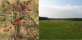
Vince continued on to the Roulette Farm, then northeast along the Roulette Farm Lane to the ravine where the Irish Brigade deployed prior to their advance toward Bloody Lane. The lane itself is hidden from view along the path of their advance until the last 50-100 yards, and some primary source evidence suggests the Confederates may have defended the position from the military crest of the ridge north of the lane for the larger part of the engagement, only becoming trapped in the lane during the final moments of the struggle for Lee’s center.

We moved south toward the lane along the path of the 29th Massachusetts Infantry, the only non-Irish regiment in the Irish Brigade, and also the only unit in the brigade armed with rifles. Their advance also aligned directly with the portion of the Sunken Road obscured by higher ground to the north. These factors combined such that the 29th suffered the lowest loss of the brigade that day. Then too, the 29th did not receive the order to charge in conjunction with the three Irish regiments of the brigade. Vince believes Brigadier General Thomas Meagher, commanding the brigade that day, intentionally left the 29th in position. Meagher states that he decided to trust the impetuosity and élan of the “Irish” in the charge. Perhaps, as Vince suggests, we should take him at his word, and not assume the order to the 29th Massachusetts miscarried.

Though the attack of the Irish Brigade did not gain the position on its own, the situation for the Confederates deteriorated rapidly as Caldwell’s Brigade moved up on the left and flanked their position in the lane. One final item of note concerns the conventional wisdom that the rebel formations defending this area disintegrated and that Lee’s army was finished if only McClellan had followed up this success in the center. But this ignores the presence of Anderson’s Division. Though engaged heavily in the fighting for the Bloody Lane, Anderson’s troops still packed enough of a punch to repulse the advance of the 7th Maine Regiment later that afternoon with heavy loss. The absence of battle reports from Anderson’s Division in the Official Records is lamentable in this case, but Vince is now working on the story of this fight from the Confederate perspective. I look forward to the results of his latest research. If Unfurl Those Colors is any indication, his conclusions will demand we approach the engagement with a fresh perspective, and may shatter long held misconceptions.

Thursday, October 16, 2008

The West Woods: A Tour with Vince Armstrong

From West Woods

Marion “Vince” Armstrong’s recent work, Unfurl Those Colors, presents an unconventional and perhaps controversial analysis of the role of Major General Edwin V. Sumner and the Second Corps of the Army of the Potomac in the battle of Antietam. On October 11, Vince guided a tour of the West Woods and Bloody Lane for members of the Save Historic Antietam Foundation, relating his conclusions with particular attention to the impact of the terrain on the events of September 17, 1862.

The tour began at and then proceeded to Cornfield Avenue at the historical western boundary of the East Woods. As a prelude, Vince discussed Sumner’s initial reconnaissance of the battlefield, which is critical to understanding the deployment of his corps. Among the gentle slopes marking the northern part of the battlefield are several commanding elevations not apparent at first glance. One of these, at the junction of the Mumma Farm Lane and the Smoketown Road, offered Sumner a clear view of the western leg of Bloody Lane, the swale northeast of the Dunker Church where Greene’s Division was deployed at the time, and the advance of the 125th Pennsylvania into the southern terminus of the West Woods.

As Sumner moved to the north along the edge of the East Woods, he noted the noise and smoke from firing in the northern edge of the West Woods, and decided to advance Sedgwick’s Division to the West Woods to secure it prior to a general advance toward the town of Sharpsburg from the north and west, as ordered by McClellan. We followed Vince along the general route of advance of Sedgwick’s troops to the position of the 1st Minnesota at the northwestern edge of the West Woods, then moved southeast through the woods to the 15th Massachusetts monument. Vince argues that the casualties sustained by these regiments and the number of rounds expended suggest a harder fight in the West Woods than many historians suggest.

Continuing southeast through the woods, Vince paused in a ravine running roughly north-south and illustrated how this feature became a channel for Barksdale’s attack against Sedgwick’s flank. He also pointed out the critical flaw in Sedgwick’s line. As the division advanced in three brigade lines, the first brigade under Gorman obliqued to the right, but the leftmost regiment, the 34th New York, failed to hear the order and continued directly west toward the southern edge of the woods just beyond the Dunker Church. In the second line under Dana, the 7th Michigan also drifted away from its brigade. Barksdale’s men, taking the path of least resistance through the ravine mentioned above, poured into the gap opened by the mistaken deployment of these two regiments with devastating consequences. Vince argued that Sedgwick’s undoing was not necessarily the unwieldy formation of his division into three lines, but the gap opened on his left by the misalignment of these two regiments.

Throughout the tour, Vince emphasized the importance of a firsthand appreciation of terrain in reaching his conclusions about Sumner and the attack of Sedgwick’s Division. The gently rolling terrain on the northern part of the battlefield is deceptive. Moving as little as 100 yards alternately reveals or obscures large expanses of the field, and elevations that appear slight from a distance may dominate the surrounding terrain in unexpected ways. Vince’s awareness of the terrain shines through in Unfurl Those Colors, and lends weight to his sometimes controversial conclusions.

Monday, October 6, 2008

Malvern Hill

From Malvern Hill

The battle field of Malvern Hill is a quiet, secluded place today, almost incongruous with the devastation wrought by concentrated Federal artillery upon hapless attempts by Lee’s infantry to dislodge Mclellan’s army from its final defensive position of the Seven Days battles. Malvern Hill is not very much a hill at all, but a slight rise hemmed in by woods and swampy creek bottoms feeding into the James River.

On this gently sloping plain, under a burning sun on July 1, 1862, sixteen guns commanded by Henry J. Hunt punished rebel infantry attacks and delivered a lesson on the awesome defensive power of Civil War artillery supported by solid ranks of infantry in the open. It was a lesson Lee would have done well to remember little more than one year later as he gazed across another expanse of open ground commanded by Federal artillery just south of the town of Gettysburg.

I followed the trail from the rebel lines toward the Federal right, and then along the Union line to the small exhibit shelter. The tiny silhouettes of several cannon marking the area of an abortive attempt by Lee’s gunners to concentrate their own artillery are visible in the distance from the line of cannon marking the Union position. There is no cover, nowhere to pause in relative safety to dress ranks, just as there was almost no chance the series of uncoordinated attacks launched across this ground would pierce the Federal defenses.

Visible along the trail just beyond the main Federal position are the vast open fields where Federal reserves watched and waited as the battle unfolded. These reserves might have been deployed for a decisive counterattack, but that remains one of the intriguing what-ifs of the Seven Days campaign.

The battlefield at Malvern Hill is easily understood from the exhibit shelter for those with no time to hike the battlefield trail. Indeed, most of the field is visible from here. A visit to the two main sites of the Seven Days Battles, Gaines Mill and Malvern Hill, makers for an easy afternoon excursion if your travels take you to the Richmond area.